A Cruise of Wisconsin’s Upper Dells
I am fortunate to live in Madison, Wisconsin – close to a wide variety of boating and scenery. Two hours West are the hills and barges of the Mississippi River, and less than an hour gets me to the free-running and hardly-developed lower Wisconsin River. Five hours Northeast is the Door Peninsula jutting into Lake Michigan, which looks a lot like coastal New England. And five hours straight north gets me to the beautiful Apostle Islands on Lake Superior. (But I’m too chicken to take the light schooner on that lake!) And of course Madison has its own lakes for sail practice, though the blue-green algae gets a bit out of control in the Summer.
And one of the gems of the state is only about an hour away. Wisconsin Dells. So we made a trip of it in Mid-July 2005. Since drought had left all the ramps on the lower Wisconsin high and dry, it seemed a good time to explore the Upper Dells, where the water level is kept in reasonable control by the dam.
If you’ve ever been to Wisconsin Dells, you’ve probably seen the ghastly tourist trap side of it. You can bypass all that, though. Cross the river on a bridge that overlooks the hydroelectric dam, then take the first left. Two blocks and you’re out of tourist hell. About a mile down is the city boat landing - $6 for a day. Being local, we had the luxury of getting there Sunday late afternoon, when all the V-8 speedboats from Illinois are taking out to brave the traffic back to Chicagoland.
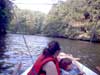
I wouldn’t bring a sailboat, and I didn’t bring the schooner’s rig. The sheer cliff banks don’t let much wind in, and you have to go under a low bridge to get out on the main river.
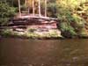
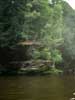
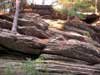
The star of the show here is the rock formations. Over most of its length, the Wisconsin river cut a wide valley over the centuries. The rock was harder here, so the river could only cut a narrow gorge.
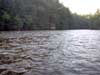
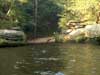
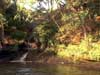
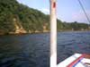
Here are the banks of the wider, lake-like part just outside the city marina.
 |
 |
Click thumbnails
for larger views |
|
|
|
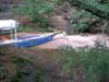
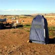
Please pardon my ugly PVC posts supporting a hastily rigged sun canopy. My beach umbrellas hadn’t come yet!
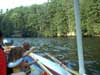
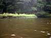
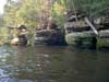
Ahead you can see the river narrowing.
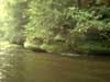
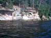
The banks start getting closer…
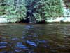
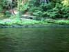
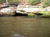
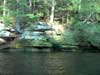
…and you start seeing cuts in the rock where creeks enter.
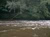
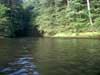
Then there are some sizeable swimming beaches, always congested with pontoon boats. After that you turn a corner and enter “the narrows”. The river can’t be more that 50 feet wide. With the low water and the dam, there was almost no current to contend with even in the narrows. Normally the current would be noticeable in the narrows.
Be prepared for getting hit by serious wakes. People on this river are not used to seeing anything but planing powerboats and large cruise boats. The cruise boats drag a major wake behind them, which then reverberates off the banks and leaves confused seas for well over a minute. They are usually finishing up the tours by the time we get into the narrows. But I’d hate to think what one of their wakes would be like in there. Most powerboaters slow down when they realize you’re a displacement boat, but often that is too late to do any good. So you get good at wake riding. Here’s a wake from a JetSki passing us. And they actually slowed down! You can see how the narrows make it tricky.
After driving through the “tourist attractions”, you’d never expect something like this.
Sometime when I’m feeling more adventurous, I’ll explore this side creek.
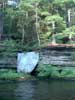
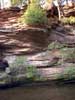
Then the rocks get taller..
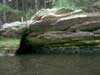
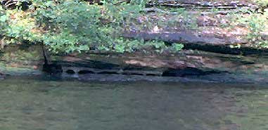
…and you start to see caves…
…and a couple little beaches between the cliffs.
More tall rocks…
…and a waterfall!
I thought this was interesting – right at the waterline, the rocks are eroded into a sort of arcade, maybe 5” high.
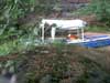
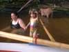
Here’s the little beach we stopped at.
As you can see, most of the bow was up on the sand. The beach drops off so quickly that the stern was in 4 feet of water. I got to test my ladder.
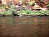
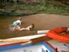
Thalia and mom found a clam. You can’t really eat these clams. Very tough meat. Raccoons like them, though. Reggie (our coonhound) had a fine time in the woods looking for those ‘coons, too.
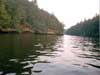
Here’s a photo downriver on the return trip, the sun low in the sky.
Due to a failed sparkplug wire that I should have replaced earlier, we had a peaceful row back to the ramp, arriving just after dark.
It’s pretty nice there. I think we might even pay the $35 for an annual boat launch permit.
Rob Rohde-Szudy
robrohdeszudy@netzero.net